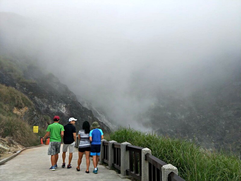
Between Taipei and New Taipei City is Yangmingshan National Park (陽明山國家公園). Famous for a variety of attractions such as many routes and peaks for hiking, cherry blossoms, the Beitou hot spring area, the smell of sulfur deposits, and the occasional venomous snake sighting, Yangmingshan is home to Taiwan’s tallest dormant volcano, Qixing Mountain (七星山), also known as Seven Star Mountain. From hiking, hot spring soaking and admiring the flora and fauna, here’s a guide to visiting Yangmingshan. (Read more: 5 Fantastic Things to do in Beitou)
The Ten Peaks of Yangmingshan
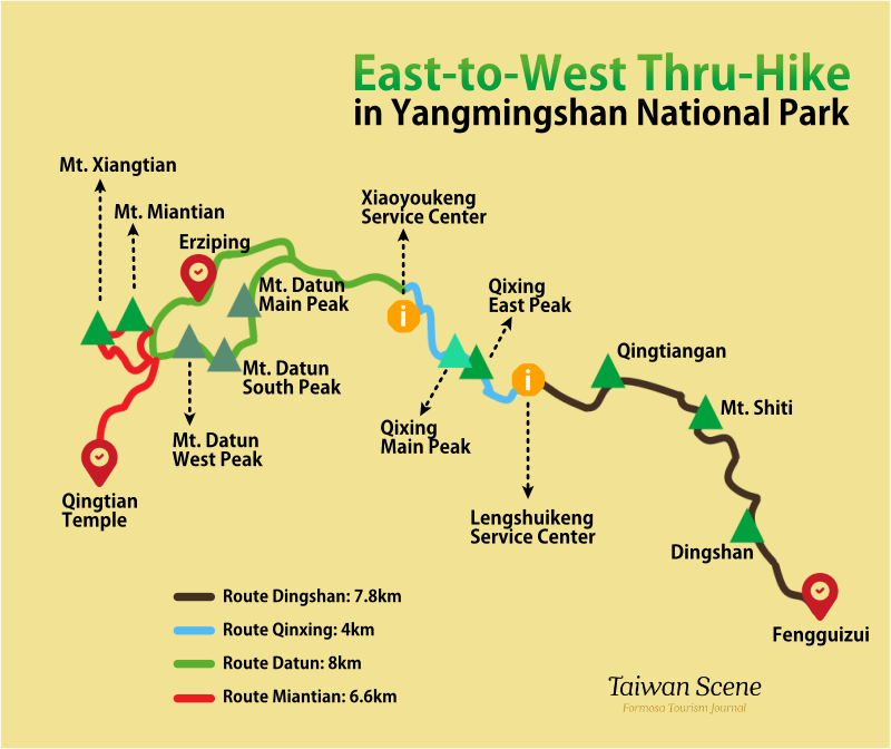
Home to ten hikable peaks, Yangmingshan is an outdoor enthusiast’s paradise. All the peaks can be conquered in one day, with the around 25km east to west hike (陽明山東西大縱走) taking on average between 11 and 12 hours. We’d only recommend this to more experienced hikers who already have a few miles in their legs. Here’s a break down of each individual peak.
1. Dingshan/Mt. Ding(頂山)
768m high, Dingshan, or Mt. Ding, in the east of the national park is Yangmingshan’s smallest peak. It is part of the leisurely Mt. Ding to Mt. Shiti trail, a 6km walk which includes you passing through the tranquil Peacock Pine Forest Area.
2. Shitiling/Mt. Shiti (石梯嶺)
Almost 100m taller (862m) than its neighbor Mt. Ding, Mt Shiti is a moderately difficult ascent, where you’ll be able to see an abundance of beautiful wild flowers. From the highest point of the mountain trail, you’ll be able to see a stunning panoramic view of the surrounding peaks.
3. Mt. Zhugao (竹篙山) / Qingtiangan Grassland (擎天岡)
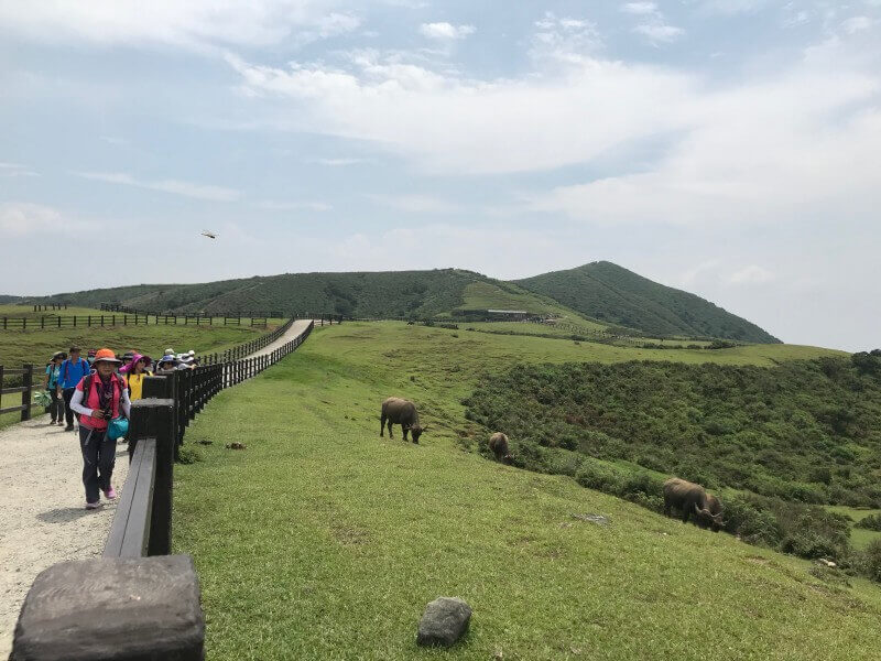
Branching off the Qingtiangan Circular Trail, the Mt. Zhugao Trail also offers excellent 360-degree panoramic views of the surrounding peaks, Qixing Mountain in particular, from its 830m-high summit. The Qingtiangang Circular Trail – including the central walking path, the Mt. Zhugao Trail, and part of the Lengshuikeng to Qingtiangang Trail – reopened in September last year after having been closed to upgrade visitor safety after two people were injured by wild cattle in 2018.
| Recommended Hiking Route in Yangmingshan: Dingshan – Qingtiangang |
| – Route: Fengguizui (風櫃嘴)→Dingshan (頂山)→Mt. Shiti (石梯嶺)→雞心崙→Mt. Zhugao (竹篙山) / Qingtiangang (擎天岡)→Lengshuikeng (冷水坑) – Distance: 7.8 km – Required time: 5~6 hrs (Average) |
| Transportation: – Departure: Take Bus M1 (市民小巴1) from MRT Jiantan Station (捷運劍潭站) and get off at Fengguizui Station (*Bus M1 has a fixed time table, departing daily at 6:10am, 10:10am, 1:10pm, 3:40pm and 5:30pm) – Return: Take Bus S15 (小15) from Qingtiangan Station or Lengshuikeng Station and get off at MRT Jiantan Station or Shilin Station (捷運士林站) (*Download Bus Tracker Taipei app [English ver. available] to check the timetable: Google play; app store) |
4. Qixing East Peak (七星東峰)
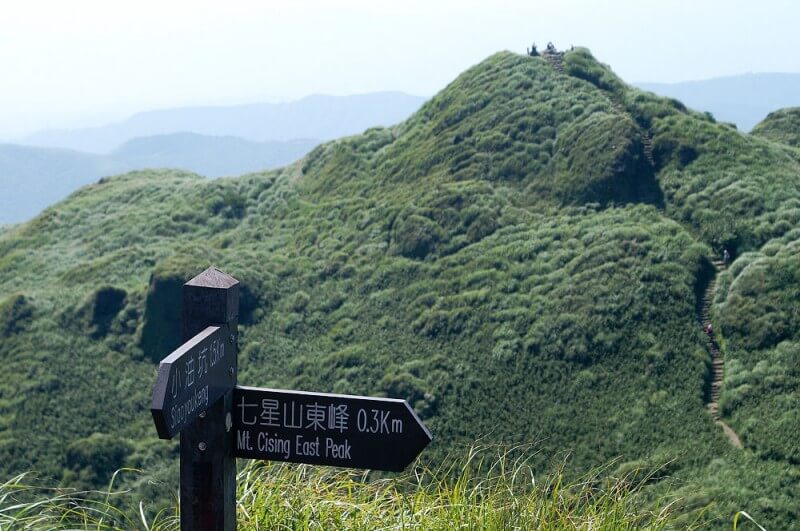
Standing at over 1km high (1,017m) Qixing Mountain’s east peak offers a steep 2.1km hike that takes you over the mountain’s pinnacle and down its east face. About half way down, the terrain flattens out and you’ll find yourself in Qixing Park, where you can take a break at the designated rest area and even head down a small side trail to see the eco-protected Menghuan (Dream) Pond. (Read more: Seven Star Mountain, a hike you a cannot miss while in Taipei)
5. Qixing Main Peak(七星山)
One of Yangmingshan National Park’s star attractions (pun intended), Seven Star Mountain is the tallest of the area’s ten peaks, standing at 1,120m. The trail is steep but stepped and while not classed as difficult, a reasonable level of physical fitness will be required to complete this hike, especially given how cold it can get when the wind is blowing. However, it’s all worth it when you get to see the view from the top.
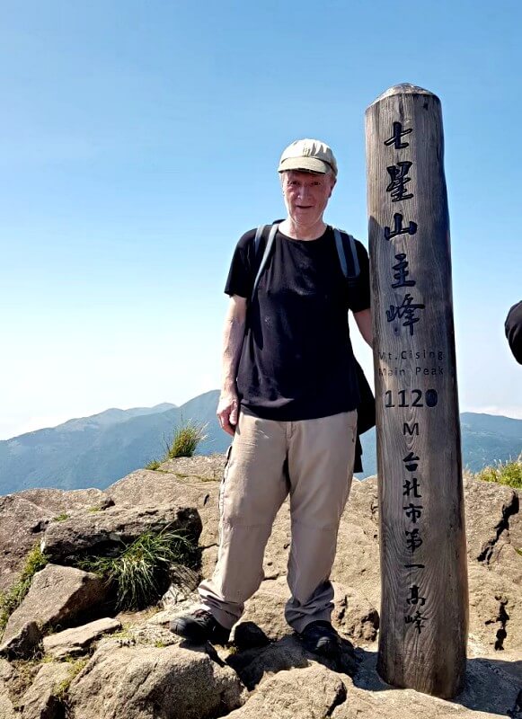
| Recommended Hiking Route in Yangmingshan: Mt. Qixing (East & Main peak) |
| – Route: Lengshuikeng (冷水坑)→Qixing east peak (七星山東峰)→Qixing Mountain (七星山主峰)→Xiaoyoukeng (小油坑) – Distance: 4 km – Required time: 2.5~3.5 hrs (Average) |
| Transportation: – Departure: Take Bus S15 (小15) from MRT Jiantan Station or Shilin Station and get off at Lengshuikeng Station – Return: Take Bus 108 from Xiaoyoukeng Service Center and get off at Yangmingshan Bus Terminal; transfer to Bus R5 (紅5) or Bus 260 and get off at MRT Jiantan Station or Shilin Station. (*Download the Bus Tracker Taipei app [English ver. available] to check the timetable: Google play; app store) |
6. Mt. Datun Main Peak (大屯山主峰)
7. Mt. Datun South Peak (大屯山南峰)
8. Mt. Datun West Peak (大屯山西峰)
Hiking Mt. Datun is a multi-peak affair, with its main peak (1,092m), south peak (957m) and west peak (982m) all having hiking trails. 8km in total and taking more than five hours if you go at a regular pace, it isn’t overly tough but perhaps isn’t one for first-time or novice hikers; especially on a rainy day. Expect to feel it in your legs the next day! Check out this from Taiwan Trails and Tales for a more detailed account of the trail.
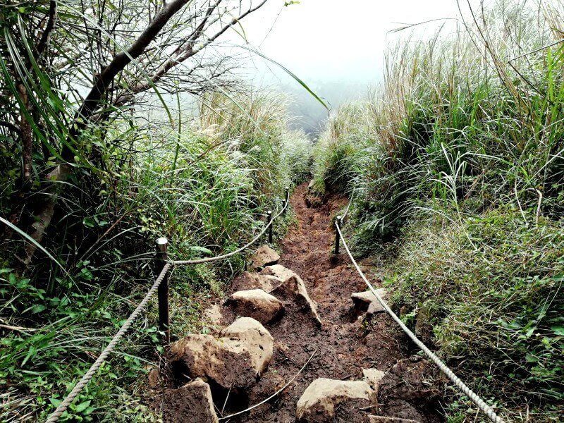
| Recommended Hiking Route in Yangmingshan: Mt. Datu multi-peak |
| – Route: Mt. Datun Trailhead (大屯登山口)→Mt. Datun Main Peak →Mt. Datun south peak →Mt. Datun west peak (982m) →Miantianping (面天坪)→Erziping (二子坪)→ Erziping Trailhead (二子坪步道入口) – Distance: 8 km – Required time: 5~6 hrs (Average) |
| Transportation: – Departure: Take Bus R5 (紅5) or Bus 260 from MRT Jiantan Station or Shilin Station and get off at Yangmingshan Bus Terminal; transfer to Bus 108 and get off at Erziping Station – Return: Take Bus 108 from Erziping Station and get off at Yangmingshan Bus Terminal; transfer to Bus R5 (紅5) or Bus 260 and get off at MRT Jiantan Station or Shilin Station. (*Download the Bus Tracker Taipei app [English ver. available] to check the timetable: Google play; app store) |
9. Mt. Miantian (面天山)
10. Mt. Xiangtian (向天山)
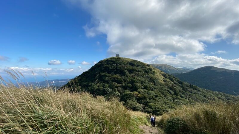
6.6km in length and 977m at its highest point, the Mt. Miantian trail is one of moderate difficulty, like most of the others you’ll find in Yangmingshan. A good place to admire wild flowers, the trail here will take you all the way to Mt. Xiangtian. 949m high, Xiangtian is the final peak of the full Yangmingshan east-to-west hiking challenge.
| Recommended Hiking Route in Yangmingshan: Mt. Miantian – Mt. Xiangtian |
| – Route: Erziping Trailhead (二子坪步道入口)→Erziping (二子坪)→Mt. Miantian (面天山)→Mt Xiangtian (向天山)→Qingtian Temple (清天宮) – Distance: 6.6 km – Required time: 4~5 hrs (Average) |
| Transportation: – Departure: Take Bus R5 (紅5) or Bus 260 from MRT Jiantan Station or Shilin Station and get off at Yangmingshan Bus Terminal; transfer to Bus 108 and get off at Erziping Station – Return: Take Bus S6 (小6) from Qingtian Temple and get off at MRT Beitou Station (北投捷運站). (*Download the Bus Tracker Taipei app [English ver. available] to check the timetable: Google play; app store) |
And if you’re not into hiking…
1. Soak in a Beitou Hot Spring
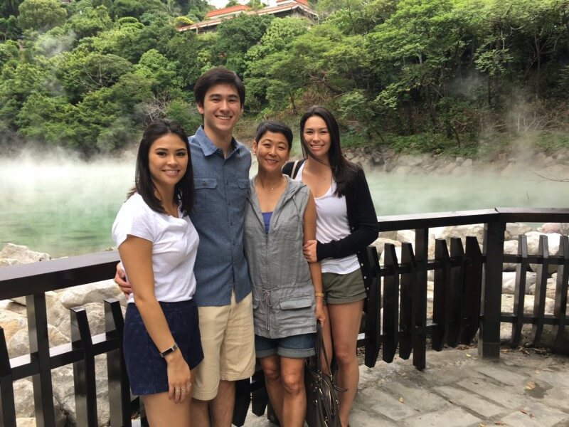
Being one of the world’s highest concentrations of hot springs and spas, Beitou, at the foot of Yangmingshan, was once voted one of Taiwan’s Top 10 Tourist Towns. Public spas and fancy, private hot spring hotels are abundant as you saunter up the hill towards Thermal Valley. In Beitou, there is a warming, comfortable soak waiting for you in Beitou no matter your budget. (Read more: The Hot Springs of Beitou – A Place of Warmth, History, and Mist-ery)
2. See the Wild Flowers
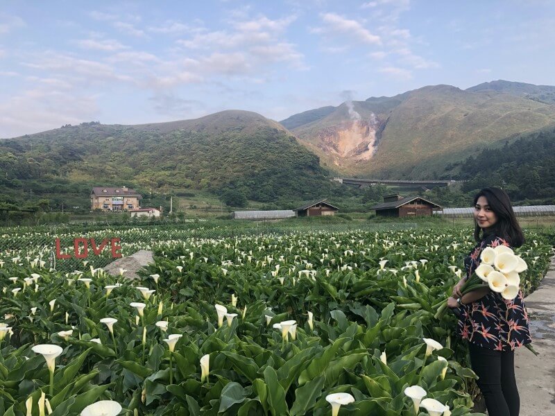
In the springtime, visit Yangmingshan’s Zuzihu/Bamboo Lake (竹子湖). Actually, despite the name, there is no lake here, instead you’ll find seas of calla lilies, a beautiful flower that represents the vitality of youth. The best way to take it all in is to go for a nice, leisurely hike or bike ride through the area (sorry, so still some hiking), with the best starting point being Zhuzihu Police Station. (Read more: Flower Viewing in Taipei)
3. Try Your Hand at Ceramics
Head to Cloud Forest Ceramics Studio (雲森陶陶工作室) for an expert-led ceramics workshop, or just drop in and freestyle it. If you don’t want to get your hands dirty, just have a potter around (see what we did there?) the onsite museum and enjoy some work from the pros. (Read more: Interview: David Pipkin, Founder of Cloud Forest Ceramics Studio)







Comments are closed.