All aboard for Taiwan’s southernmost national scenic area, built around twisting, turning, churning deep-valley rivers near the bottom of Taiwan’s beauteous Central Mountain Range!
Where is Maolin National Scenic Area? This heavily forested recreation area is east, and almost equidistant, from the southern Taiwan urban areas of Tainan and Kaohsiung cities. Long and thin, with a north-south orientation, it’s spread out among the low foothill peaks of Taiwan’s thick mountain spine. The NSA has three major sections, south, middle, and north, centered on settlements spaced out along the rugged mountain-exiting access rivers. All the major settlements are indigenous. (Read more: Visiting Kaohsiung, Southern Taiwan’s Largest City)
The great range of available experiences means each time you visit the NSA you can create an entirely different trip. Members of the Rukai (魯凱族) and Paiwan (排灣族) tribes, which share many cultural elements, live in the south, Rukai in the middle, Tsou (邵族) and Bunun (布農族) in the north. There are also abundant hot-spring resources (with quality inns), scenic high-view trails (with guided tours available), mass butterfly-migration valleys, indigenous-artist studios, camping facilities, whitewater rafting … the list goes on, but we’ll end it here.
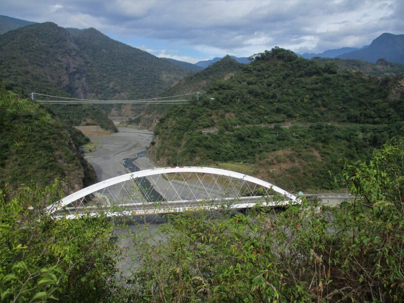
The NSA’s three sections are spaced out along the wide – riverbed, that is – Laonong River (荖濃溪), almost dry during quiet periods, a sight to behold when typhoons visit. Here we present must-visit spots on a multi-day exploration of the middle and north sections, both significantly tourist-quieter than the south section.
Purple Butterfly Valley (紫蝶幽谷)
The middle section is centered on the wildly sinuous Zhuokou River (濁口溪), a Laonong tributary, and the scenic Maolin Forest Road (Kaohsiung County Route 132), almost always high as a crested serpent eagle – a Maolin NSA icon – above it. Visit the welcoming Maolin Visitor Center, right at the river’s mouth where Provincial Highway 27 and the Maolin Forest Road meet, especially if you need help with trail-walk guide services and inn/homestay accommodations. (You might also like: Travel Deeper to the Lavender Forest in Taichung: Find your direction through yoga and dancing with the fireflies)
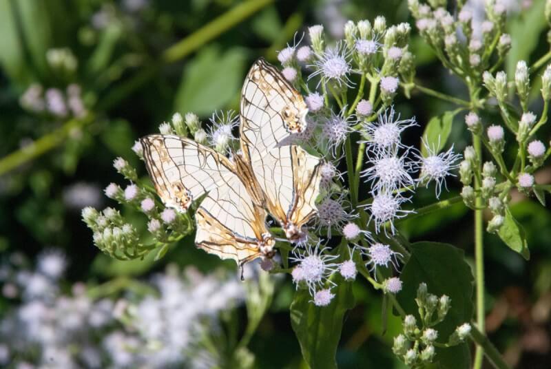
The high-slope Rukai village of Maolin is the epicenter of a series of valley areas collectively called the Purple Butterfly Valley. The Maolin NSA is one of only two over-wintering butterfly valley areas worldwide, the other Mexico’s Monarch Butterfly Valley. At any one time, a million or more Purple Crow Butterflies may be found wintering here, the majority around Maolin village. The prime viewing area is Maolin Ecological Park, taking up trail-interlaced forest on the mountainside above the village. The village’s visitor center has good displays with solid English on the region’s butterfly life, and provides free trail-guide services (for English, phone 0919-219-944; best to call well ahead).
Dragon Head Mountain Trail (龍頭山步道)
About halfway from Maolin to the Rukai village at road’s end for tourists, Duona (多納), is the parking lot and entrance for this easy-grade paved/boardwalk trail of magnificent panoramas. It runs along a narrow, serpentine dragon’s-back-like ridge, the spine of Dragon Head Mountain, that soars high as an eagle above the riverbed. In some sections there’s little more than airspace on both left and right, this area’s madly twisting river seen past your feet on both sides. At dusk and dawn groups of eagles glide along the deep, twisting valley here, giving rise to the name Eagle Valley (老鷹谷).
Duona Village (多納)
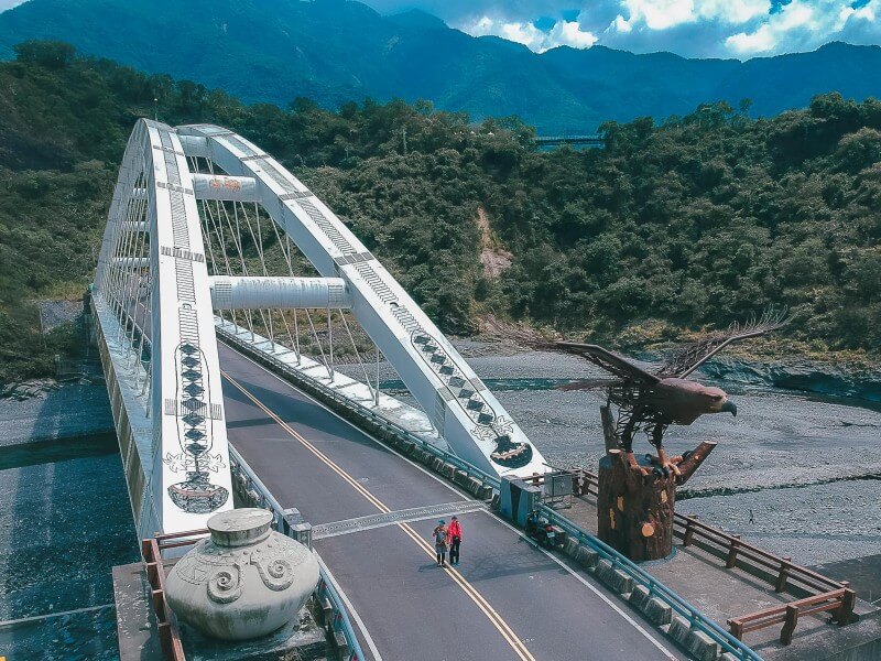
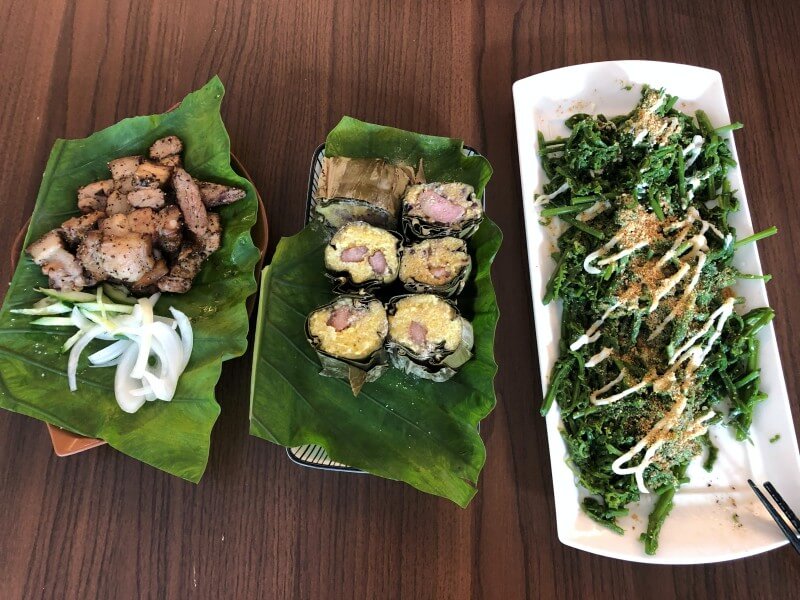
The highway continues past Duona, but is open to local traffic only. Though there is a real sense of remoteness and isolation in this small plateau-perched settlement, it is at the same time very busy with tourists on weekends/holidays. Duona has preserved about 30 traditional Rukai slate houses, the largest concentration in Taiwan. The main street (the village is closed to outside vehicles; parking lot available) is lined with eateries and cafes. Buy delicious mountain boar, sausages, taro, sweet potato, and other local goodies fresh-grilled the traditional Rukai/Paiwan way on stone slabs. Be sure as well to sample the coffees made with local Duona beans (Arabica). Note that Duona also offers quality homestay accommodations. (Read also: 3 Tribes You Need to Visit in Eastern Taiwan)
Duona High Suspension Bridge (多納吊橋)
The trail leads to this lofty suspension bridge, a photographer’s delight visible from both trail and highway, which here crosses the river near the chasm’s bottom. The bridge, 203m long and 103m high, is Taiwan’s highest. Built during the Japanese colonial period (1895~1945), it was long the only way to reach Duona. It was also known as Lover’s Bridge, for this spot saw many tears shed as people said goodbye to sweethearts (and family members, and friends) leaving for the outside world.
Duona Warriors’ Trail (多納勇士步道 )
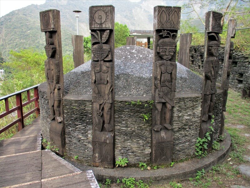
In the settlement, signs lead you to this trail, which climbs a village-side mountain slope and provides splendid high-on views of village goings-on. Along the pathway are replicas of traditional structures where, long ago, warriors placed their status-enhancing hunted heads, stored hunted meats, and called out their illustrious deeds.
Baolai Hot Springs (寶來溫泉) – Kaohsiung’s Maolin NSA Hot-Spring Jewel
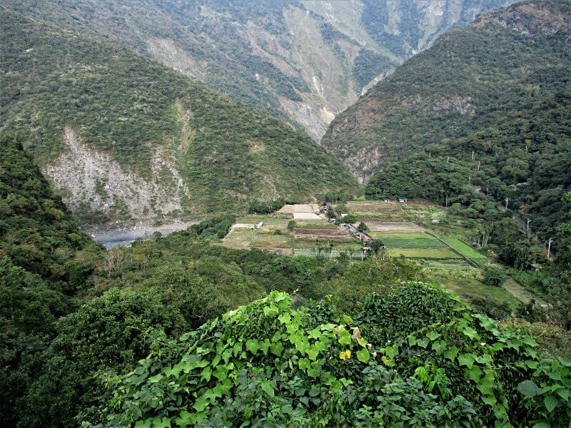
Take the charming Provincial Highway 27 along the Laonong River to reach the NSA’s north section and Baolai village. This highway hugs the riverside mountain base and passes through pretty, colorful small-farm scenery. Baolai’s rustic hot-spring resorts are mostly clustered along a Laonong tributary, the Baolai River. The weak carbonic-acid mineral waters here have a source temperature of about 60 degrees Celsius. High up the mountain slope above the river is the young Baolai Flower & Hot Spring Park, opened in 2017. Enjoy superb mountain vistas here while enjoying the inexpensive public-access soaking facilities – full-body, foot, and hand. (If you like hot springs: Five Wild Hot Springs in Taiwan)
Ready to float through Mother Nature’s majestic artwork like a butterfly — or soar through it like an eagle? Southern Taiwan’s Maolin National Scenic Area awaits!
How to Get to Maolin?
Self-drive is strongly recommended. Recommended for the above-suggested itinerary is a car rental at the Tainan High Speed Rail Station or car/scooter from around the Tainan Railway Station, Prov. Highway 28 to the middle section, then Prov. Highway 20 (one of Taiwan’s most scenic) back from the north. Local bus service (www.ptbus.com.tw; Chinese) is also available from Pingtung City (regular-railway station service); three lines to the south, one to the middle.
For more information, check these websites: www.maolin-nsa.gov.tw / taiwan.net.tw
Words by Rick Charette / Cover Photo by Zero 日落









Comments are closed.